
The Sydney Speleological Society is very active in producing cave maps, we have published well over 2000 cave maps!!!
Maps are produced by many SSS members and are generally published in the Journal. These maps are produced in many grades from simple hand drawings to high quality vector images.
The following images are a sample of a cave map produced by Erik Halbert (a life member of SSS):
Rain Cave NSW Blue Mountains SSS Map # 1910 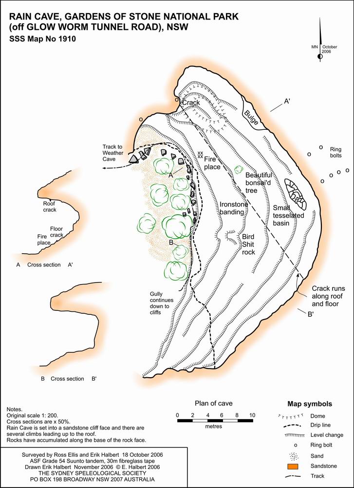 |
Banyaning Cave Quarantine Beach North Head, Sydney SSS Map # 1772 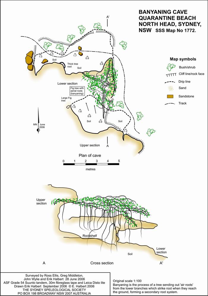 |